


‘Tinsuong volcano’: Never seen photos now on Hmarram.com
BACKGROUND: In early 2010, the people of Hmar Hills were shocked and rattled by the news that a volcanic activity had begun on the outskirts of Tinsuong village in Churachandpur district of Manipur after huge tracks of landslide down on the eastern side of the settlement. The news soon spread far and wide prompting religious preachers to appeal to the Hmar tribe to “repent” for their “sins and “return to the ways of God”. Mass prayers were held across villages in Hmar Hills so that the “wrath of God” would not be unleashed upon the community. Much to the dismay of a few people with scientific temper, no government officials nor the Geological Survey of India team cared to visit the site leaving rooms for various interpretations based on assumptions and rumours.
So, on December 23, 2010, despite warnings from villagers of both Tinsuong and my native village not to go there, I took my youngest brother and a cousin to visit the spot. The mission was to witness what really was on the ground that was causing panic. “Remember, none had dared to go and checkout it out..not even hunters,” was the last advice from a relative of Tinsuong village. He pointed the route and left us with an excuse.

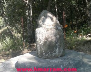
A view of the western section of the flattened portion of the land facing Pherzawl village. From far, this area with a wet look appears to be flowing molten lava to the locals. On the ground, we made sure that the liquid was nothing but water.

This hole when seen from far looks as if it was some kind of volcanic lava. On the ground, it was nothing but a small waterhole wherein some insects reside.
(Dated 10th September, 2010 zana Tinsuong khuo suotiengpanga Mimkei chu tu chen hin an la chawl nawh. A hnuoitienga vadung Bawk Vadung, Tuikuol le Tuijang hai chen in se takin an la luong zing a nih. Mimkei in a suksiet ram hi Tlangram pa inkhi dan in Fing sawm (Ft. 10) ding lai a tlinga, lo neituhai inkhi dan in (Lo fing khat hi bu tin thum in tu thei na a ngai a nih)
![]()
James
13 years agoHmmm….This is Mud Volcano! Rare geomorphic process! If ‘m not mistaken, 2004 khawm khan CCpur area a um ve! Mud-volcanoes are less violent eruption/extrusion of watery mud or clay.
Mud volcano hi a tlangpuiin subsurface (hnuoi a thu) layer hnipna hmuna tui le pil hai overpressured in a tuomna hmuna a um nuom bik hlak. Chun lines of fracture, faulting, or sharp folding tina hmun haia khawm a um hlak. Hnuoi sunga methane gas hung suok dawk tum lei khawm’n a um hlak bawk. Ei ni haiin volcano ei ti hai ang tak2 hi chu a ni naw, amiruokchu an khawsak dan, shape le an thil hung phu dawk dan hai chu an ang tlangpui!
Ringlien
13 years agoI was there in Hmarram when this happened and it was shocking to see how preachers forecast it as the end of days for the Hmar tribe!